



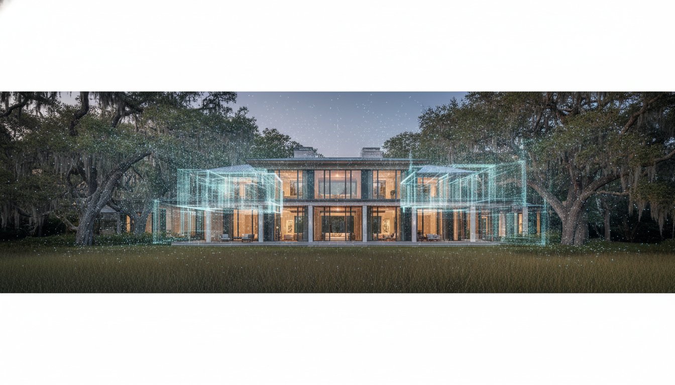
In the high-stakes world of Lowcountry luxury real estate, a beautiful photograph is no longer the ceiling of property presentation; it's merely the floor. You've likely felt the frustration of a high-value listing stalled by inaccurate floor plans or the challenge of conveying a waterfront estate's true renovation potential to an out-of-state buyer. Relying on outdated sketches or simple virtual tours often leads to costly disputes and missed opportunities during the due diligence phase.
Understanding what is bim scanning for real estate marks the essential transition from traditional marketing to true architectural intelligence. By capturing the as-built environment with laser precision, you move beyond surface-level aesthetics to provide a data-rich digital replica that architects and designers can use immediately. This technology transforms a physical property into a collaborative asset, ensuring every square foot is documented with the meticulous detail that the elite markets of Hilton Head and Bluffton demand.
This guide explores how Scan-to-BIM workflows, utilizing the latest Autodesk Revit 2026 standards, provide a foundation for seamless project coordination and superior property management. You'll discover how to leverage these sophisticated tools to minimize construction change orders, satisfy technical requirements, and reinforce your reputation as a tech-forward professional in the South Carolina Lowcountry.
Key Takeaways
• Understand the transition from traditional property media to architectural intelligence through data-rich 3D representations of high-value estates.
• Learn how to provide architects and custom builders with BIM-ready files that jumpstart design projects and minimize costly construction change orders.
• Discover what is bim scanning for real estate and how it validates the spatial accuracy of complex coastal footprints and historic Lowcountry properties.
• Explore the technical workflow of LiDAR scanning, from the initial point cloud capture to the creation of a precise digital replica.
• Leverage sophisticated scanning services to establish your authority as a technically credible professional in the Hilton Head, Bluffton, and Beaufort markets.
Defining BIM Scanning in the Modern Real Estate Landscape
Sophisticated property presentation has moved beyond the lens of a camera. While professional photography captures the soul and atmosphere of a Lowcountry estate, it lacks the geometric depth required for technical decision-making. To understand what is bim scanning for real estate, one must view it as the creation of a data-rich digital asset rather than a mere visual gallery. It is the process of using high-precision laser technology to generate a comprehensive Building Information Modeling (BIM) file, which acts as a living, three-dimensional record of a structure's physical and functional characteristics.
This shift from "visual marketing" to "spatial data assets" represents a significant leap in how high-end properties are managed. For luxury listings in Hilton Head or Bluffton, providing "as-built" documentation is becoming a professional standard. It offers a level of transparency and technical fidelity that validates a property's value through indisputable spatial accuracy. Instead of relying on decades-old paper blueprints, stakeholders now utilize a precise digital replica that serves as a single source of truth for every professional involved in the property's lifecycle.
The Evolution of Property Documentation
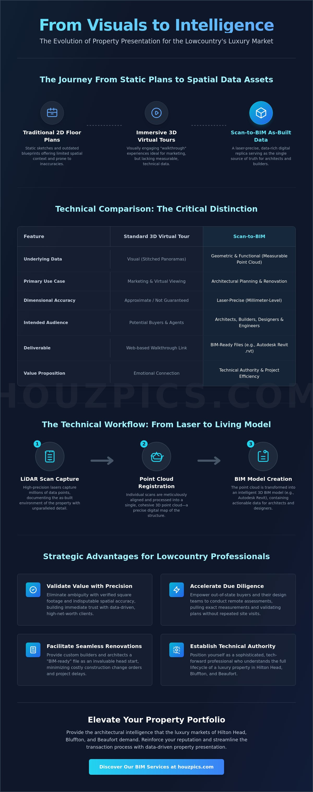
The journey of property documentation has progressed from static 2D floor plans to the immersive, yet technically limited, 3D virtual tours of the last decade. While these tours provided a sense of flow, they lacked the precision needed for high-stakes architectural work. Luxury markets demand more. A white-glove digital experience now includes high-fidelity data that allows out-of-state buyers to consult with their own design teams remotely. In the historic districts of Beaufort or the private clubs of Hilton Head, this level of documentation ensures that the architectural integrity of a legacy estate is preserved and understood with absolute clarity.
BIM vs. Standard 3D Virtual Tours
The distinction between a standard 3D virtual tour and a BIM scan is found in the underlying data. A virtual tour is a visual representation, essentially a series of stitched panoramic images that provide a "walkthrough" experience. It's designed for the human eye, not for structural planning. Conversely, BIM scanning produces measurable data. Architects and interior designers can't use standard 3D tours to calculate structural loads or verify precise wall thicknesses, but they can integrate BIM files directly into their design software. BIM is the gold standard for architectural integrity in digital media, providing the foundational intelligence that standard photography simply can't deliver.
Strategic Advantages for Luxury Agents and Custom Builders
In the exclusive enclaves of the South Carolina Lowcountry, property value is often tied to architectural complexity and renovation potential. When professionals ask what is bim scanning for real estate, they're looking for a competitive edge that goes beyond traditional marketing. This technology allows agents to validate a listing price through indisputable spatial accuracy. By providing a verified square footage calculation derived from a laser-precise point cloud, you eliminate the measurement ambiguities that often plague older waterfront estates or historic Beaufort properties. This precision builds immediate trust with analytical high-net-worth individuals who prioritize data-backed investment decisions.
Positioning yourself as a technically credible partner involves more than just showing a home; it's about facilitating the property's entire lifecycle. For out-of-state buyers, a BIM scan reduces the logistical burden of repeated site visits. Their architects and consultants can "walk" the property and pull exact measurements digitally, allowing for a more decisive due diligence period. This level of foresight establishes the Realtor as a sophisticated consultant who understands the long-term needs of a luxury homeowner.
Facilitating Seamless Renovations
For custom builders and interior designers, receiving a "BIM-ready" file is an invaluable head start. This holistic process of creating and managing information ensures that design teams can plan bespoke cabinetry or structural modifications without the risk of manual measurement errors. Integrating this data with professional property photography provides a comprehensive view of both the aesthetic and the structural reality of the space. Precise as-built data is a powerful tool for reducing construction change orders, which typically arise from undocumented existing conditions, ensuring that renovation projects in Hilton Head stay on schedule and within budget.
Elevating the Listing Presentation
In competitive markets like Bluffton, a data-backed listing presentation distinguishes a professional from the standard field. Providing a digital twin offers a psychological advantage, signaling to buyers that the property has been meticulously documented and maintained. These digital assets serve as a permanent record for the new homeowner, simplifying future maintenance or additions. To integrate this level of architectural intelligence into your next high-value listing, you might consult with a specialized media studio to see how technical data can enhance your professional dialogue.
The Technical Process: From Laser Point Clouds to Architectural Intelligence
The transition from a physical structure to a sophisticated digital asset begins with Light Detection and Ranging (LiDAR). This technology pulses laser light to measure distances with sub-centimeter accuracy, capturing millions of individual data points in seconds. In the context of understanding what is bim scanning for real estate, this phase is purely about geometric truth. It isn't about capturing colors or textures for a marketing brochure; it's about mapping the exact skeleton of a property with mathematical certainty. These millions of points form what is known as a "Point Cloud," which acts as the foundational raw data for every subsequent architectural decision.
Unlike traditional photography, which can be distorted by wide-angle lenses or overprocessed HDR effects, the point cloud provides an undistorted record of the property’s geometry. This raw data is then meticulously converted into a structured model. This conversion process is where raw points become intelligent architectural elements, such as walls, windows, and structural beams. For luxury estates in the Lowcountry, this level of technical precision is essential. It ensures that the digital replica is not just a visual representation but a reliable tool for structural analysis and precise planning.
Understanding the Point Cloud
LiDAR technology essentially "sees" through a room, bouncing light off every visible surface to capture its exact position in 3D space. This creates a dense cloud of coordinates that defines the volume and dimensions of the environment. It's important to distinguish this from a "mesh," which is often used in basic virtual tours to create a simple visual shell. While a mesh is a collection of triangles representing a surface, a BIM model is an object-oriented database. Houzpics prioritizes this technical precision, ensuring that the final output is an intelligent model where every component is recognized as a distinct architectural element rather than just a shape.
Software Interoperability
The true utility of a scan is realized when the point cloud is converted into industry-standard formats like .RVT (Revit) or .DWG (AutoCAD). These files integrate directly into the workflows of Lowcountry architects and builders, allowing them to start renovation or restoration projects with high-fidelity as-built data. By providing "clean" data, we maintain the architectural integrity of luxury homes in Hilton Head and historic properties in Beaufort. When a professional opens a Revit 2026 file, they're working within a precise environment that reflects the actual conditions of the estate, eliminating the manual drafting errors that often lead to project delays.
BIM Applications in the Lowcountry: Preserving and Planning High-Value Estates
The unique architectural fabric of the South Carolina Lowcountry requires more than generic documentation. From the antebellum structures of Beaufort to the modern coastal masterpieces on Hilton Head Island, the question of what is bim scanning for real estate finds its most practical answers in preservation and precision. This technology allows professionals to capture the exact state of a property, ensuring that the legacy of a historic home or the complexity of a new waterfront build is documented with total accuracy.
Waterfront estates often feature complex coastal footprints designed to maximize vistas while adhering to strict environmental setbacks. Spatial modeling allows architects to analyze the "view-to-room" relationship with mathematical certainty. By mapping the interior volumes against the exterior landscape, designers can ensure that every primary suite and living space perfectly aligns with the natural horizons of the Atlantic or the May River. This level of spatial intelligence is a hallmark of sophisticated property management in our region.
Historic Preservation and Restoration
In Beaufort, restoration projects often face the challenge of undocumented modifications made over centuries. BIM scanning captures intricate moldings, structural settling, and complex joinery that 2D sketches inevitably miss. This ensures any restoration work honors the original architectural intent with absolute fidelity. Professionals looking to integrate this technical depth into their broader brand positioning should explore Real Estate Marketing: The Complete Guide to see how technical authority wins high-value listings.
New Construction and Custom Builds
In communities like Palmetto Bluff, custom builders utilize BIM to document the "as-built" state before the drywall is installed. This captures the exact placement of mechanical, electrical, and plumbing systems. Having a digital twin of these "behind-the-walls" components is a significant asset for future maintenance, allowing homeowners to locate infrastructure without invasive exploration.
Interior designers in Okatie and Skidaway Island use these digital twins to plan bespoke furniture layouts and custom millwork remotely. By integrating drone imagery with BIM data, we capture the full scale of an estate, from the intricate roofline to the specific property boundaries. This collaborative approach ensures that every stakeholder, from the architect to the landscape designer, works from a single, precise dataset. To secure this level of architectural intelligence for your next project, schedule a technical consultation with our Lowcountry studio.
Elevating Your Property Portfolio with Houzpics BIM Integration
Adopting BIM technology is more than a technical upgrade; it's a fundamental shift in how we perceive and present high-value property. By moving away from the limitations of traditional point-and-shoot media, you provide your clients with an architectural-grade asset that facilitates future renovations and maintains its utility through multiple property transfers. Integrating these models into your workflow provides the definitive answer to what is bim scanning for real estate by proving that data is the most valuable asset in a luxury transaction. It transforms a listing from a temporary advertisement into a permanent digital legacy.
Houzpics positions itself as the calm, technically credible expert for the Hilton Head, Bluffton, and Beaufort markets. We understand that our role is to enhance the professional dialogue between you and your clients. Our studio focuses on providing sophisticated property presentation that respects the architectural integrity of every estate we scan. Experience the efficiency of our workflow by visiting the Houzpics portal, where you can streamline your booking process and access your digital assets with ease.
The ROI of Architectural Precision
Precision is a professional insurance policy. For a custom builder, a BIM scan validates the meticulous craftsmanship of a project by documenting its structural reality. For a luxury Realtor, it protects your reputation by ensuring every spatial claim is backed by verifiable data. This level of transparency is essential when dealing with the discerning clientele of the Lowcountry. It's a strategic investment that stays with the property, providing long-term value that basic photography cannot match. It is essential to understand the nuances of hiring a professional who can bridge the gap between artistic vision and technical data, ensuring your portfolio reflects the highest standards of the industry.
Your Strategic Partner in the Lowcountry
Our commitment to technical excellence is balanced by a deep appreciation for the aesthetic nuances of coastal architecture. We prioritize realism and natural light sophistication in every project, avoiding the distorted imagery and unrealistic colors that can detract from a property's true character. This restraint ensures that the final digital twin feels as authentic as the physical home itself. We invite you to elevate your next project with our specialized scanning services. Contact our studio for a technical consultation on your high-value listings or architectural projects, and discover how our focus on quality and architectural integrity can expand your business reach.
Architectural Intelligence as a Standard for Excellence
The transition from standard property media to data-driven architectural intelligence is an essential evolution for the Lowcountry luxury market. By integrating precise spatial data into your workflow, you move beyond aesthetic appeal to provide a verifiable digital foundation for every architectural decision. Understanding what is bim scanning for real estate allows you to offer a level of transparency and technical fidelity that sophisticated buyers and builders now expect. These assets ensure that the architectural integrity of a property is preserved and understood throughout its entire lifecycle.
Whether you're preserving a historic Beaufort landmark or launching a new waterfront build on Hilton Head, our editorial-quality results validate your professional referrals. Houzpics provides bespoke architectural media tailored specifically to the nuances of our region's high-end residential market. Our team of technically informed specialists ensures that every scan respects the craftsmanship of the property, delivering results that support both the sales and renovation cycle. This meticulous approach reinforces your status as a tech-forward professional in a competitive ecosystem.
Elevate your property presentation by shifting from simple photography to a comprehensive digital twin. We invite you to Book Your BIM Scanning Consultation and discover how our collaborative approach can enhance your professional dialogue. Let's build a more precise future for the Lowcountry's most exceptional estates.
Frequently Asked Questions
How is BIM scanning different from a Matterport 3D tour?
BIM scanning captures precise geometric data points to create an intelligent 3D model, whereas a Matterport tour is primarily a visual walkthrough designed for marketing. Matterport provides an immersive sense of flow, but it lacks the sub-centimeter accuracy required for structural documentation. BIM data integrates directly into professional architectural software, allowing for structural analysis and renovation planning that standard virtual tours simply cannot support.
Can an architect use BIM scan data for structural renovations?
Architects utilize BIM scan data as the foundational as-built record for structural renovations and historic restorations. Because the scan captures the exact position of load-bearing elements and existing infrastructure, it eliminates the guesswork associated with manual measurements. This precision is vital for the complex coastal architecture found in Bluffton and Hilton Head, ensuring new designs align perfectly with the home's existing skeleton.
How long does a BIM scan take for a typical luxury home in Hilton Head?
A professional scan of a typical luxury estate in the Lowcountry generally requires several hours on-site, depending on the square footage and architectural complexity. Larger waterfront properties with intricate layouts or multiple structures may take a full day to capture thoroughly. This time investment ensures every corner of the property is documented with the high-fidelity point cloud data necessary for professional modeling and information management.
Is BIM scanning only for new construction, or does it work for existing homes?
BIM scanning is highly effective for both new construction and existing properties. For existing homes, it's often referred to as Scan-to-BIM, a process that creates a digital twin of a building where original blueprints may be lost or outdated. This is particularly valuable for historic Beaufort properties, providing a precise digital record that facilitates modern updates while preserving the original architectural integrity and craftsmanship of the home.
What file formats are provided after a BIM scan is completed?
We provide several industry-standard file formats, most commonly Autodesk Revit (.RVT) and AutoCAD (.DWG) files. These formats ensure seamless interoperability with the software used by most architects and builders in the South Carolina Lowcountry. Additionally, clients may receive the raw point cloud data in formats like .RCP or .E57, allowing for flexible use across various design and information management platforms during the building's lifecycle.
Do I need special software to view the results of a BIM scan?
You don't necessarily need expensive architectural software to view the basic results of a BIM scan. While architects use programs like Revit or ArchiCAD for design work, there are free viewers available that allow Realtors and homeowners to explore the 3D model. However, to leverage the full technical potential of the data, professional-grade software is required to manipulate the architectural elements and metadata contained within the model.
How accurate is the measurement data from a professional BIM scan?
Professional BIM scanning utilizes LiDAR technology to achieve sub-centimeter accuracy across the entire structure. This high level of precision is the primary reason professionals ask what is bim scanning for real estate when managing complex, high-stakes listings. It ensures that every measurement, from wall thickness to ceiling height, is captured with a degree of certainty that manual tape measures or basic laser tools simply can't match.
Why should a real estate agent invest in BIM scanning for a listing?
Luxury agents invest in BIM scanning to establish themselves as technically credible experts who prioritize the long-term interests of their clients. Providing a data-rich digital asset validates the listing's value and reduces the likelihood of spatial disputes during the due diligence phase. It also serves as a sophisticated referral tool, offering architects and designers a significant head start on any planned renovations for the new homeowner.


